SHENANDOAH RIVER MAP
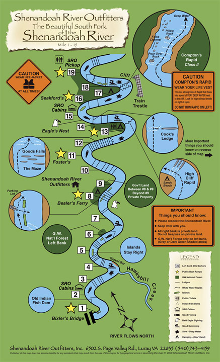
BOAT LANDINGS WE USE
#1: Low Water/Bixler’s Bridge (VA Game)
#8: Bealer’s Ferry (G.W. National Forest)
#11: Foster’s (VA Game)
#13: Good’s Falls (G.W. National Forest)
#16: Seakford’s (G.W. National Forest)
#19: Burner’s Bottom (G.W. National Forest)
#20: SRO Property Boat Landing
NOTABLE MENTIONS
#17.5: Compton Rapids (Class 2)
Check out this example of: Paddling Through Compton Rapids
G.W. National Forest: Dark green shaded areas on left bank- all other areas along the banks are private property.
Shenandoah River Outfitters Inc & publishers of these maps do not assume liability for any accidents that may result from the use of this map or for any typographical errors in describing the river.
Please respect and help keep the river clean! Keep litter/trash with you.